The Hayling Billy Trail: Route, Access Points and Who Can Use It
The old Hayling Billy railway line now carries walkers, cyclists and riders up the western shore of the island. Here is the route, where to join it, what the surface is like and what is changing.
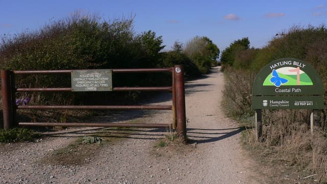
The Hayling Billy Trail is an off-road route along the former railway line on Hayling's western shore. Walkers, cyclists including e-bikes, mobility users and horse riders may use it. The northern 1.2km is resurfaced as an all-weather route, and the southern 1,100m is due to be upgraded.
The Hayling Billy Trail runs along the former railway line that linked Havant with the southern end of Hayling Island, passing beside Langstone Harbour with wide views and plenty of birds. It is part of National Cycle Network route 2 and the Shipwrights Way long distance path, and the King Charles III England Coast Path also uses it according to Havant Borough Council.
Who can use it
Havant Borough Council states that the only users allowed on the Trail are walkers, cyclists (including e-bikes), scooters (although the council notes this is a matter of legal debate), users of mobility transport such as wheelchairs, and equestrians. The Council's 2019 Hayling Island Transport Assessment notes the route is owned by Hampshire County Council and Havant Borough Council and is not a public right of way, and a Hampshire cycling leaflet calls it a permissive route.
The route
The trail's northern end is at the Havant Road (A3023) car park opposite the "GE On The Move" garage, from where the resurfaced section runs south to the North Hayling Halt car park. A Hampshire leaflet describes a short stretch of about half a mile north of North Hayling Halt, where the track ends at the top of Hayling Island and you can still see the piles of the old railway bridge that carried the line to Havant. The trail continues south down the island and ends at the Station Road and Sinah Lane junction in West Town, close to the Station Theatre, the former station.
Havant Borough Council lists these access points: the Havant Road car park, the North Hayling Halt car park, Victoria Road (near the Esso garage), Saltmarsh Lane and Denhill Close (public footpath 521), and the Station Theatre at the southern end. West Lane and Staunton Avenue are also named as nearby roads.
Coming from the mainland, the Chichester Harbour Conservancy's Hayling Island Cycle Route leaflet starts at the free public car park by The Ship pub at Langstone, crosses Langstone Bridge, then crosses the road near the petrol station and heads through a small car park to join the trail. The bridge carriageway is 6.5 metres wide with 2-metre off-carriageway cycle tracks on both sides, according to the council's transport assessment.
Surface and works
The northern 1.2km section was resurfaced in a scheme the council funded with £600,000 from the Active Travel Fund (round 4) in 2023/24, creating, in its words, "a truly all-weather, all-year route". Havant says a further £500,000 grant from Active Travel England was confirmed in September 2026 for the southern 1,100m, from the Station Theatre northwards. The council intends most of the improvement to be built before Christmas 2026, with final surface dressing in spring 2027, so expect works near the southern end. The more difficult central sections are exposed to coastal erosion and flooding, and the council says future improvements may not all be on the same line as today's trail.
History in brief
The railway opened to passengers in 1867 and closed in 1963 under the "Beeching" cuts, and it was nicknamed the Hayling Billy. See our history guide.
Wildlife on the way
The path overlooks Langstone Harbour, a Site of Special Scientific Interest. A Hampshire leaflet says to look for large flocks of brent geese, oystercatchers and dunlin in winter, and whitethroat and willow warbler in the hedgerows in summer. Please keep dogs under control and give birds space.
Share this article